Pinpoint permit filings for fiber, 5G, data centers, and utility infrastructure—across 2,450+ jurisdictions, covering 85% of the U.S. population.

Telecom Infrastructure Intelligence
Shovels uses proprietary LLM strategies to tag and classify hundreds of millions of building permits to identify high-growth areas where active or future telecom infrastructure is being deployed.
Our fiber permit classification reveals where ISPs and network providers, from Tier 1s like Verizon, Comcast, and T-Mobile to Tier 3 providers, are actively building, enabling strategic market entry decisions and investment prioritization.
We identify permit-friendly jurisdictions by analyzing historical approval timelines, approval rates, and construction patterns, so you can route around difficult authorities and streamline deployment.
Monitor construction activities that could impact existing telecom infrastructure. Detect construction near network elements early for damage prevention and strategic planning.
Identify new construction areas where telecom companies can install fiber infrastructure. Find opportunities to be part of new developments as they're being built.
Identify high-demand areas with construction density analysis. Focus on construction density rather than population data alone, ensuring optimal network placement.
Map contacts and approval patterns across thousands of jurisdictions. Navigate the complex permit landscape with jurisdiction timeline intelligence.
Telecommunications permit database
Power faster, smarter telecom infrastructure deployment.
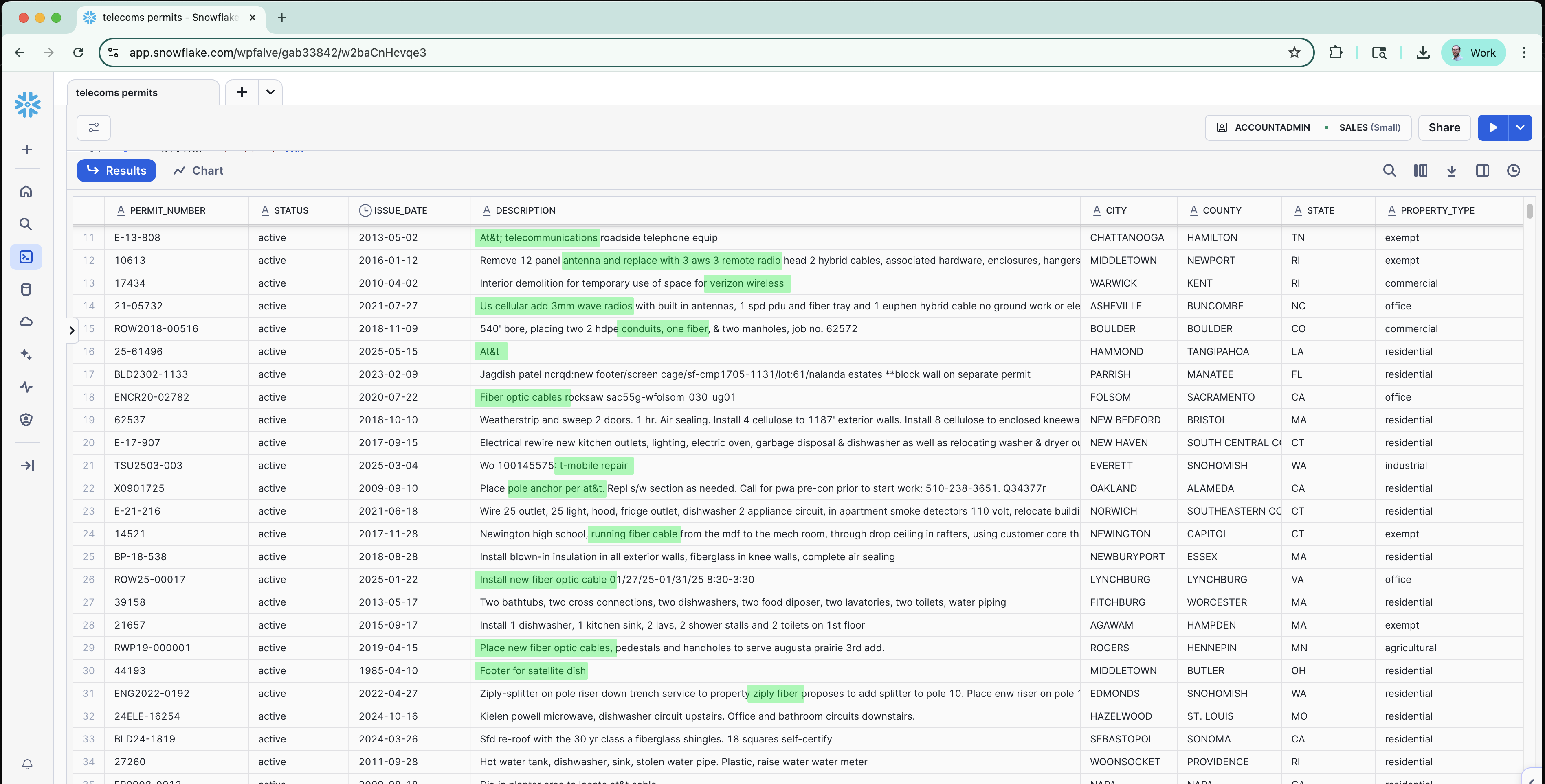
Address the unique pain points faced by telecommunications companies in infrastructure planning and deployment.
Avoid permit bottlenecks with jurisdiction timeline intelligence. Identify permit-friendly jurisdictions and streamline deployment processes.
Track fiber builds before market entry decisions. Monitor competitor activity across target markets to inform strategic planning.
Identify high-demand areas with construction density analysis. Focus resources on markets with the highest growth potential.
Map contacts and approval patterns across thousands of jurisdictions. Build relationships with key decision-makers in target markets.
Before fiber permits are filed, city councils debate broadband expansion, right-of-way permissions, and franchise agreements. Shovels Decisions data gives you visibility into these discussions months before ground breaks.
Know when cities are reviewing telecom agreements and negotiating terms that will impact your infrastructure deployment timeline.
Identify municipalities prioritizing internet infrastructure and where council support indicates favorable markets for expansion.
Track discussions about utility corridor access and identify potential obstacles or opportunities in your network planning.
Monitor where federal broadband dollars are being allocated and understand which cities have council backing for infrastructure projects.
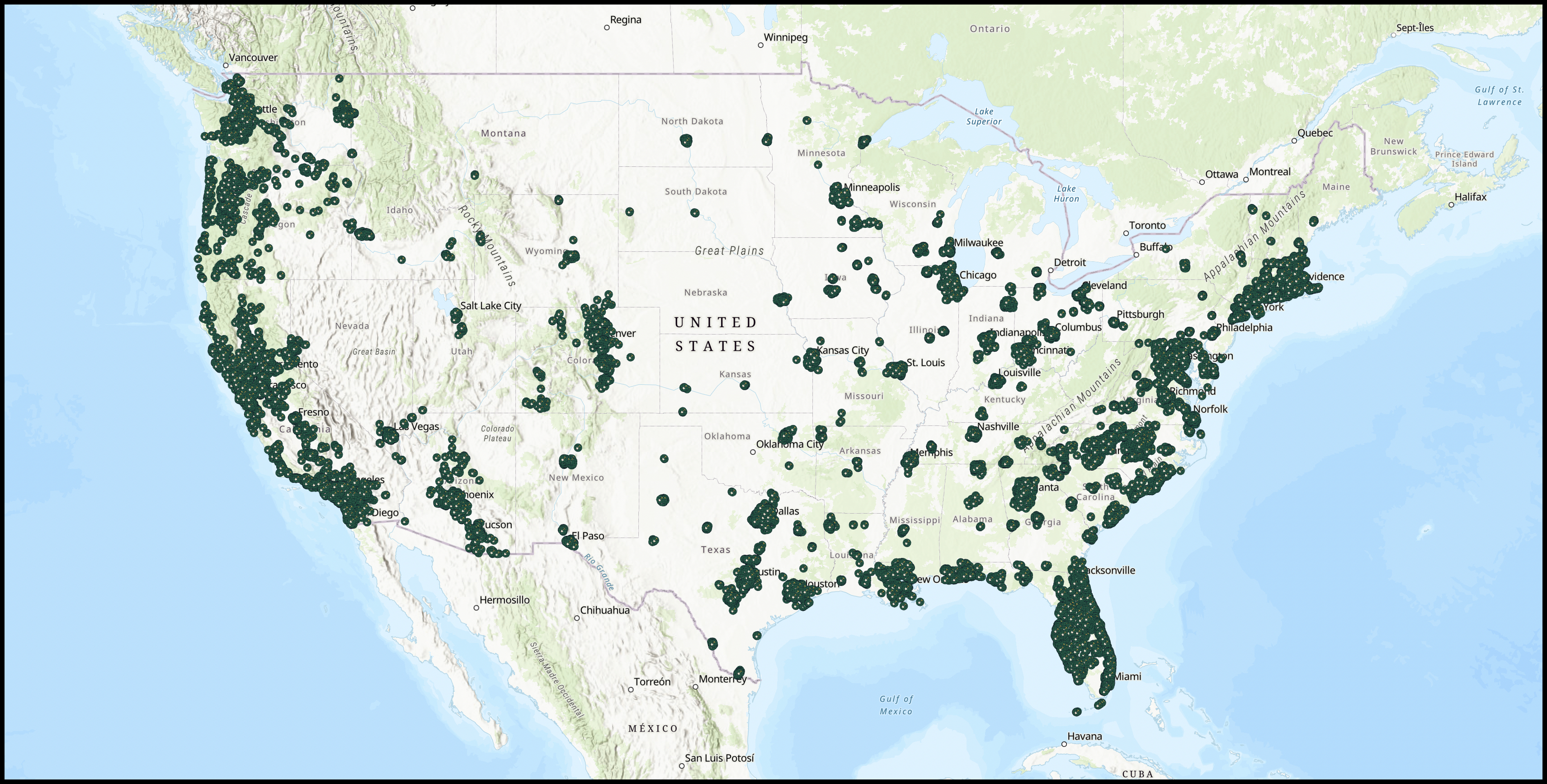
Geospatial intelligence powering your telecom strategy
Building permits are inherently geospatial objects that provide the earliest signal of market activity. Through our Esri partnership, empower your GIS team to visualize internet, new construction, and other high-signal permits to strengthen your telecom strategy. ArcGIS Web Map
Shovels Decisions data provides intelligence from city council meetings and planning boards where broadband expansion, franchise agreements, and right-of-way permissions are discussed. This gives you visibility into telecom infrastructure projects months before permits are filed, allowing you to plan network deployment and identify favorable markets earlier than competitors.
Shovels tracks franchise agreement discussions, broadband expansion initiatives, right-of-way permit debates, and BEAD funding allocation priorities from city councils and planning boards nationwide. This policy-layer intelligence helps you identify municipalities prioritizing internet infrastructure and understand which projects have council backing.
Shovels analyzes historical approval timelines, approval rates, and construction patterns across thousands of jurisdictions. This intelligence helps you route fiber deployment around difficult authorities and streamline your infrastructure planning by focusing on jurisdictions with faster, more predictable permit processes.
Yes. Our AI-enhanced fiber permit classification reveals where ISPs and network providers—from Tier 1 carriers like Verizon, Comcast, and T-Mobile to Tier 3 providers—are actively building. This competitive intelligence enables strategic market entry decisions and helps you prioritize investment in underserved areas.