
Shovels Shovels - Building permit and contractor intelligence
Data · Properties

Every property, tied to its full permit history

Shovels ties permits, contractors, and residents to standardized addresses and parcels, so you can look up any US property and see the work behind it.
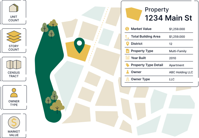

Illustration of a property linked to its permit history
SOC 2 certification seal

Shovels is SOC 2® Type II certified

Shovels meets enterprise security and compliance requirements. Our SOC 2 Type II certification reflects controls independently audited over a sustained period, not just a point-in-time snapshot.

Read more about our security practices →
Our process

From messy addresses to one clean property record

  1. 01

    Sourced from permit records

    Every property starts as an address on a permit, published by cities and counties in hundreds of inconsistent formats.

  2. 02

    Standardized and deduplicated

    Addresses are USPS-standardized and merged with variants into canonical records with persistent geo IDs.

  3. 03

    Geocoded and resolved to parcels

    Each property is pinned to lat/long coordinates and linked to its parcel (APN) using multiple authoritative sources.

  4. 04

    Enriched with assessor records

    County tax assessor data adds property type, year built, size, and value. Every field is documented in our data dictionary.

Shovels field worker

What's in every property record

See more in our data dictionary
Address
USPS-standardized and geocoded, with a persistent geo ID.
Parcel
Parcel data including parcel number (APN), boundaries, and county identifiers.
Permit history
Every permit filed at the address, with status and work type.
People
The contractors who did the work and the residents who live there.
Attributes
Property type, year built, size, and assessed value from tax assessor records (Enterprise).
The data

One address, one complete story

01

Verify property history before you act

See exactly what was permitted at any address before you underwrite, buy, or close.
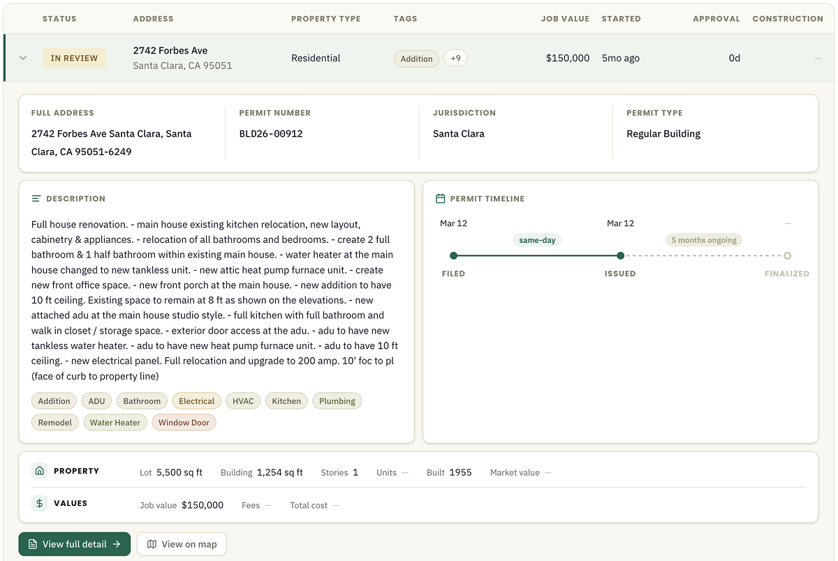
  • Pull complete permit history by address in seconds
  • Spot unpermitted work by comparing records against property condition
  • Check the age of the roof, HVAC, or water heater from past permits
Shovels.ai
Property history record with a permit timeline

02

Screen properties at scale

Match entire portfolios against permit history instead of checking addresses one by one.
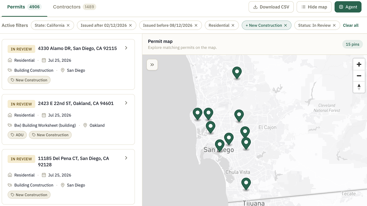
  • Match your portfolio or book of business via the API
  • Find properties with no recent permits
  • Monitor addresses for new filings with every release
Shovels.ai
Book-of-business address list matched to permit records

03

Build property-level features

Persistent geo IDs and geocodes make Shovels data easy to join with other datasets.
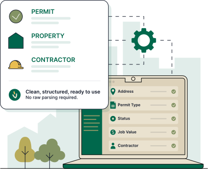
  • Address-level metrics via the API
  • Geocodes and geo IDs for clean joins with internal data
  • Assessor attributes like year built and assessed value in Enterprise
Laptop showing permit, property, and contractor data-object cards
Delivery

Delivered where the decision gets made

Shovels Online

Explore, filter, and export permit, contractor, and decision data in our self-serve web app.

Learn more

Shovels API

Build construction intelligence into your product, CRM, or internal tools with our REST API.

Learn more

Enterprise

Get the full dataset as parquet files or table shares in Snowflake, Databricks, or BigQuery.

Learn more

USED BY TEAMS IN

Building Materials Construction Technology Energy & Climate Home Services Real Estate Telecommunications Research Insurance
COVERAGE

Coverage across the U.S.

We source data from thousands of jurisdictions online and offline through public records. New jurisdictions are added continuously based on market trends & customer demand, with coverage spanning all major metros and expanding rural markets.
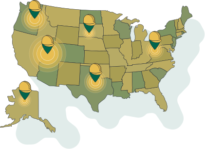
Map of the United States with markers showing Shovels permit data coverage across the country
Data types

Explore the connected datasets

Every property is linked across datasets, so you see the full picture — the permits, the contractors, and the people behind each address.

Decisions
Zoning and land-use decisions, public as much as eighteen months before a permit is filed.
Learn more
Permits
Every building permit we cover, AI-classified into structured records.
Learn more
Contractors
Contractor profiles with licenses, work history, and contact details.
Learn more
Residents
Residents and homeowners tied to properties, with contacts.
Learn more

Frequently asked questions

What property data does Shovels have?

Every property in our dataset has a standardized address, geocode, and parcel linkage, plus its full permit history and the contractors and residents connected to it. Enterprise customers can add tax assessor attributes like property type, year built, size, and assessed value.

How do I look up permit history by address?

Search the address in Shovels Online, or resolve it to a geo ID with the API and pull every permit filed there: work type, status, dates, values, and the contractors who did the work.

Can I tell what condition a property is in?

Permit history is a strong proxy. You can see when the roof was last replaced, whether the HVAC or water heater has been updated, and whether renovations were permitted.

What property attributes are included?

Standardized address, lat/long geocode, parcel number, and geographic IDs on every record. Assessor attributes such as property type, year built, building area, and assessed value are available through an Enterprise Data License.

How do I access property data?

Three ways: search any address in Shovels Online, integrate the Shovels API, or license the full dataset via Snowflake, Databricks, or BigQuery.

Look up any property's history

Search for free, or talk to us about API and enterprise delivery.