


It’s been a few weeks since we got back from the Esri User Conference in San Diego, and we're still buzzing!
If you've never been: the Esri UC is the annual gathering of the GIS world; thousands (17k?) of people who spend their days thinking in layers, projections, and basemaps, all converge in one convention center for a week. We spent the week in the Startup Zone with a kiosk, a screen full of maps, and a suitcase of Shovels-branded swag.
Here's what we saw, what we heard, and why we're already blocking off next July.
The room is bigger than you think
The scale of the UC is hard to convey until you're standing in it. The plenary alone feels like a small city convening. Walk the exhibit hall and you'll pass a startup mapping bee populations, a state DOT team, a utility crew, an imagery company flying its own planes, and a university lab, all next to each other.
What struck us most was how deep the Esri ecosystem runs. We came in thinking of ArcGIS as a product. We left understanding it as an economy. Esri has dedicated industry specialists for AEC, commercial real estate, utilities, water, airports, transportation, and government, people whose entire job is knowing how their corner of the world uses spatial data. Several of them stopped by our booth just to talk shop and connect us with others working on adjacent problems. That generosity was a theme all week.
What people wanted to talk about
We lost count of the conversations at the kiosk, but a few themes came up over and over:
- Site selection, site selection, site selection. Far and away the most common. Home builders, retail chains, restaurant groups, logistics teams, all asking a version of the same question: where is new construction happening, and how do I know about it early? Permit data turns out to be a pretty good answer, and watching people arrive at that on their own was one of the best parts of the week.
- "Where are neighborhoods being built out?" Adjacent to site selection, but distinct: expansion planning. Teams that want to know where the next rooftops will be before they're built.
- Addresses that don't exist yet. Delivery and logistics teams liked the idea of seeing new addresses months before the first package shows up.
- Roofs. Roof age and roof condition came up constantly from the insurance side.
- Canada. More requests than we expected. We heard you.
- Local government. A lot of interest from city and county GIS teams thinking about permit digitization and modernization. There's real energy in the public sector right now around making this data usable, and it was great to hear it firsthand.
And the biggest structural lesson for us: a lot of people don't want a data file at all — they want a map. Not an API, not a bulk export, not the dataset building blocks that drives Shovels customers today. A layer they can turn on inside the environment they already live in. It sounds obvious written down. It's different when forty people in a row tell you directly.
Ian took the mic
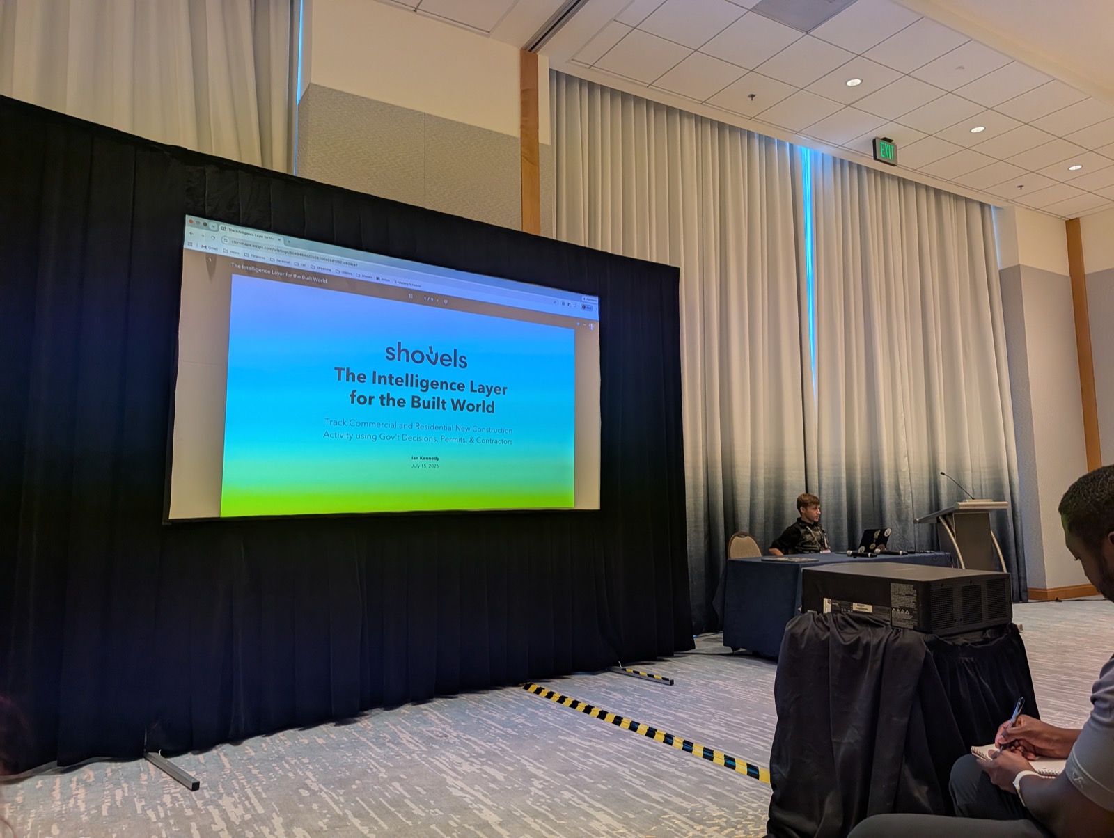
One of our favorite moments: our in-house GIS expert, Ian Kennedy (of Mappy Monday fame on LinkedIn), was invited to speak at the Real Estate Special Interest Group session. He built a Story Map for it and walked the room through what national permit data looks like when you put it on a map.
The Q&A was the best part, real questions from people who clearly work with this data every day. The talk brought a steady stream of people to the booth afterward, and it confirmed something we'd suspected: this community would rather see a map than a slide.
We'll be raising our hand for more speaking slots in the future.
The news we're most excited about
Esri announced official support for GeoParquet in web maps. If you're not in the weeds on this, it's easy to skip past, but for anyone trying to put a very large number of points on a map, this is a genuinely big deal. It removes the ceiling we've been designing around for a while.
What this means for Shovels: we're now on a path to mapping every permit, everywhere, all time — in one layer. We're building toward that, and the UC is where it clicked.
The fun parts
- Meeting partners - face-to-face conversations with partners can’t be beat. Great conversations all around.
- The mini shovels were a phenomenon. We brought shovel-shaped bottle openers as swag and ran out on day one. People came back for them. People sent colleagues for them. We are ordering many, many more.
- We ran out of one-pagers too, which is a good problem and a lesson for next year.
- Our customer lunch at Lou & Mickey's, across from the convention center, was a highlight — two tables full of customers, partners, and new friends talking about permits over lunch.
- We got a team photo with Jack Dangermond (Esri founder), below.
- Our maps on the Living Atlas — including the LA County wildfire map, drew people over from across the aisle. Having something visual and specific on screen beat any pitch we could have written.
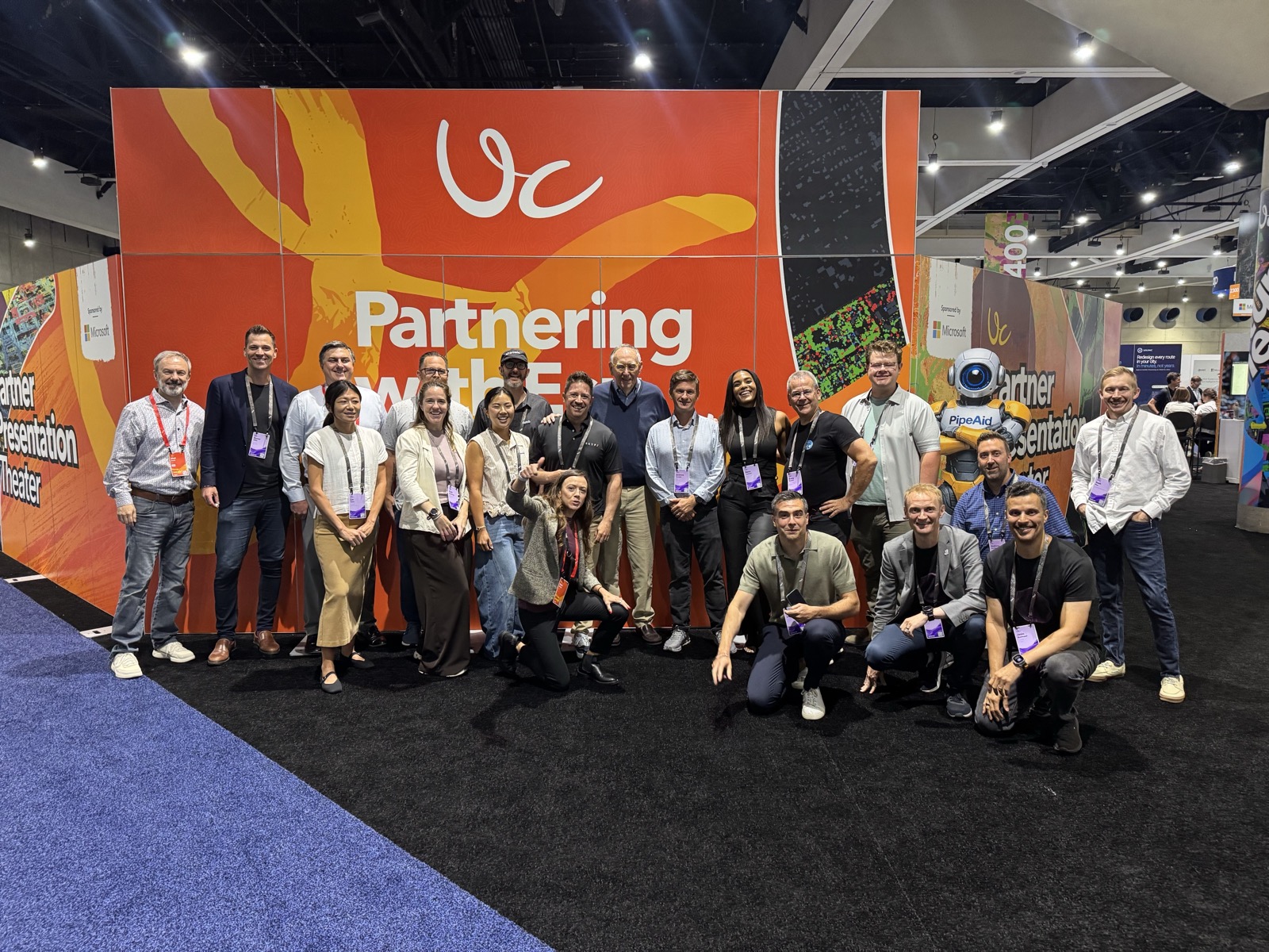
Thank you, and see you next year!
Enormous thanks to the Esri Startup Program team for making room for companies like ours, and to everyone who stopped by the kiosk to tell us what they're building. We came to San Diego to show off some maps and left with a much clearer picture of what the GIS community actually needs from permit data.
If we talked at the booth, or if you missed us and want to see what we showed, our maps are on the ArcGIS Living Atlas, and we're always up for a conversation.
See you in San Diego next year. We'll bring more shovels.